Hackney Wick is a pocket of East London with a rich history of heavy industrialization and modest, ramshackle housing. Its growth was spurred, among other factors, by the construction of the Hertford Union Canal in 1830.
The slow decline of many industries after the Second World War, followed by rapid deindustrialization in the 1970s, had a significant impact on East London. While Docklands is probably the best known example of this, Hackney Wick was similarly affected.
During the late 20th century, the area fell into decline, and the factories and warehouses were left empty or rented out to artists or small creative businesses. Around the time of the construction of the nearby Olympic Park, a major regeneration project was launched to revitalise the area. Thousands of new homes have already been built, with more developments still in progress.
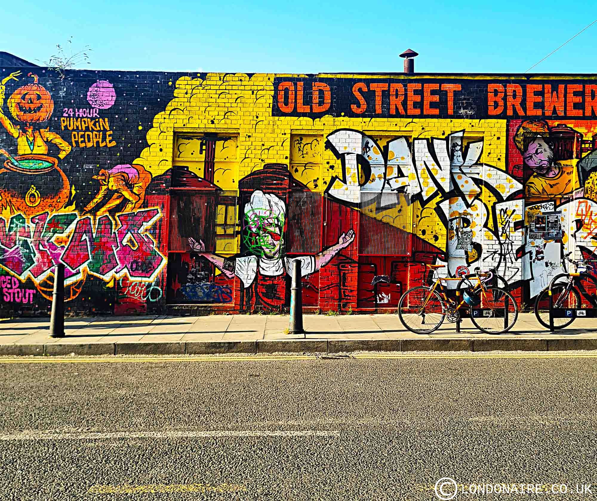
Today, Hackney Wick is one of the most fascinating areas of London to explore. The industrial past is still very much in evidence, but the vibrancy and exuberance of the art scene are even more striking. Every building, it seems, serves as a canvas for glorious street art in saturated colours.

Part open air art gallery, part building site – that’s Hackney Wick as it stands today.
If you go and visit, do check out the local newspaper, The Wick, for more insights on local artists and businesses, and the challenges that come with the slow gentrification of the area. The paper copy is free to pick up from many local businesses.
How to get to Hackney Wick: Hackney Wick station is on the Overground line that goes to Stratford (the Mildmay line, as per the new Overground lines naming, although that hasn’t been implemented yet).
If you want to see more off-the-beaten path London, I wholeheartedly recommend Trinity Buoy Wharf, another site with a strong industrial past revitalised by art and small creative businesses.
Street art is everywhere, and you see it as soon as you leave the Hackney Wick station. The photo on the left was taken from inside the station; the photo on the right is what greets you when you exit.


Walk to the left towards Wallis road (right in front of you) and turn right when you get there, and you’ll get to this helpful (and delightful) map by the Hearth Bakery.

The map wasn’t kidding about the octopus…


In contrast, Gainsborough Primary School is as chocolate box pretty as can be, no street art there. Akasa, in the first photo, is a repurposed warehouse. And the third picture is the Lord Napier, the local boozer. I’m earmarking that roof terrace for my next visit to the area…


Hackney Wick is bounded by water on 2 sides (the Hertford Union Canal on its south border and the river Lee on its eastern side), and you’ll see plenty of boats… Some of them lived in, some of them not.


Cool bridge over the canal towards Fish Island…


Housing stock from repurposed old buildings vs new housing stock being built. And street art/ graffiti everywhere.


Art everywhere… The bottom photo is of a piece by artist Perspicere, which is rather unique in being made up of threads rather than paint.


Some of the art pieces are beautifully timeworn… you can tell Hackney Wick has been an artist community for a long time…


If you like this post, maybe you’d like to subscribe to the newsletter, for updates, exclusive content and the occasional special offer? I will never spam you or sell your data, I promise. Here’s my privacy policy.


")
